Reported Earthquakes: Week of Oct 26–Nov 1, 2026
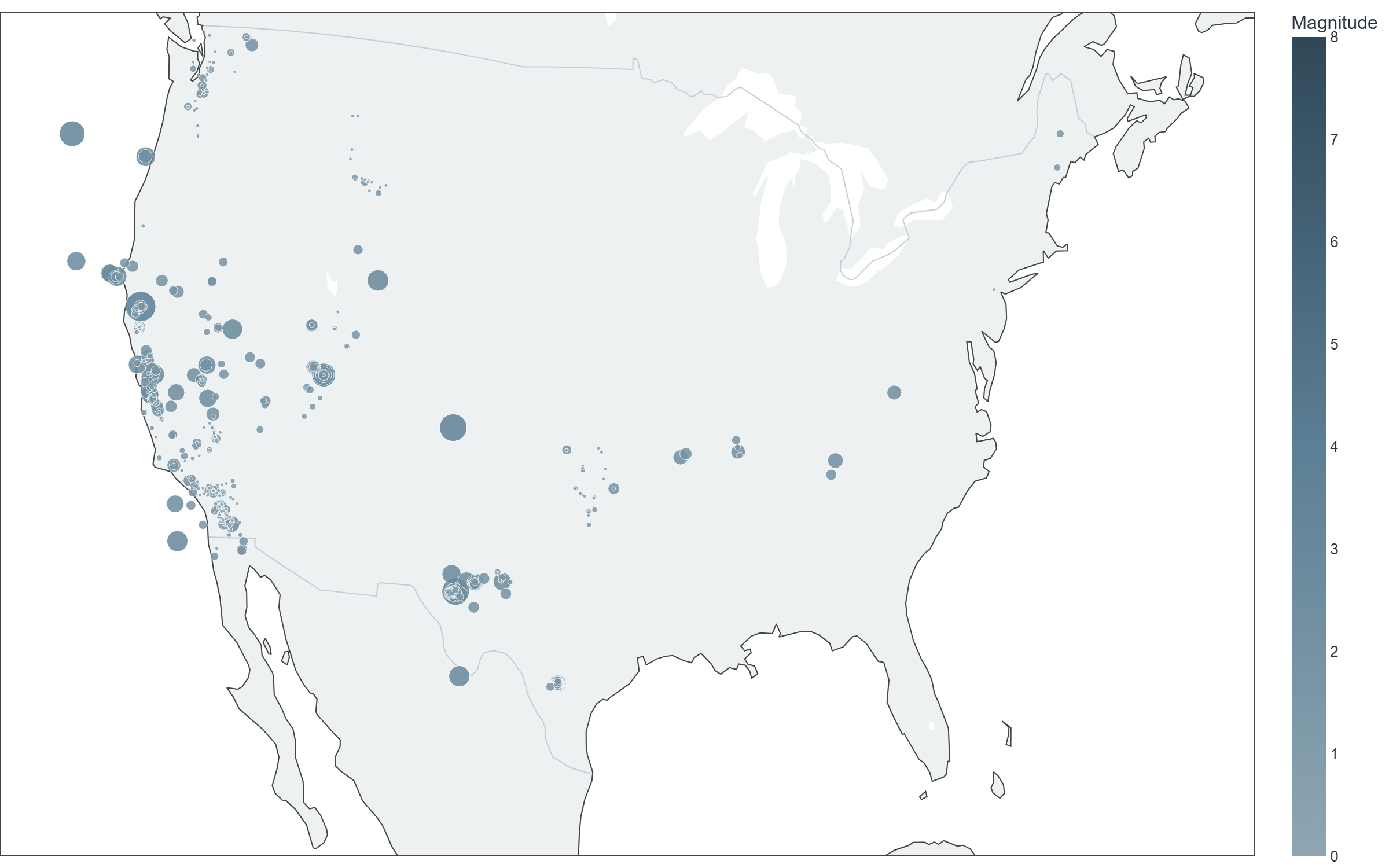
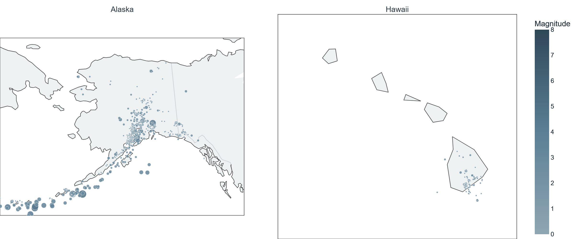
Every reported earthquake is shown, sized and colored by magnitude on a fixed scale (consistent week to week). Alaska and Hawaii are shown at their own scale — see the note below on why.
USGS-monitored sensors recorded 1671 reported earthquakes across the United States and its territories for the week of October 26 to November 1, 2026, including 159 at magnitude 2.5 or greater. The largest, a magnitude 5.0 event, was recorded near 143 km S of False Pass, Alaska on October 29 (20:14 UTC).
State & territory breakdown
| State/territory | Reported | Largest magnitude |
|---|---|---|
| Alaska | 630 | M5.0 |
| California | 619 | M4.0 |
| Hawaii | 96 | M2.7 |
| Texas | 69 | M3.0 |
| Washington | 45 | M2.2 |
| Utah | 44 | M3.3 |
| Puerto Rico | 31 | M4.1 |
| New Mexico | 30 | M3.7 |
| Oklahoma | 30 | M2.0 |
| Nevada | 18 | M2.9 |
| Montana | 17 | M1.7 |
| U.S. Virgin Islands | 9 | M3.8 |
| Oregon | 7 | M3.5 |
| Unresolved (CONUS) | 6 | M1.9 |
| Tennessee | 5 | M2.4 |
| Wyoming | 2 | M3.0 |
| Arkansas | 2 | M2.4 |
| Idaho | 2 | M1.8 |
| Missouri | 2 | M1.7 |
| Maine | 2 | M1.6 |
| Colorado | 1 | M3.7 |
| West Virginia | 1 | M2.3 |
| Virginia | 1 | M1.4 |
| Arizona | 1 | M1.4 |
| New Jersey | 1 | M1.1 |
Source: USGS Earthquake Hazards Program (public data). Magnitude 2.5+ is shown on the map as a readable threshold; the total above includes all magnitudes USGS recorded for the week. Reported activity reflects what instruments recorded — it is not a judgment about risk to any specific place. Full unfiltered catalog: USGS Earthquake Map.
Download Consilium
See regional safety signals for your neighborhood in the Consilium app.
